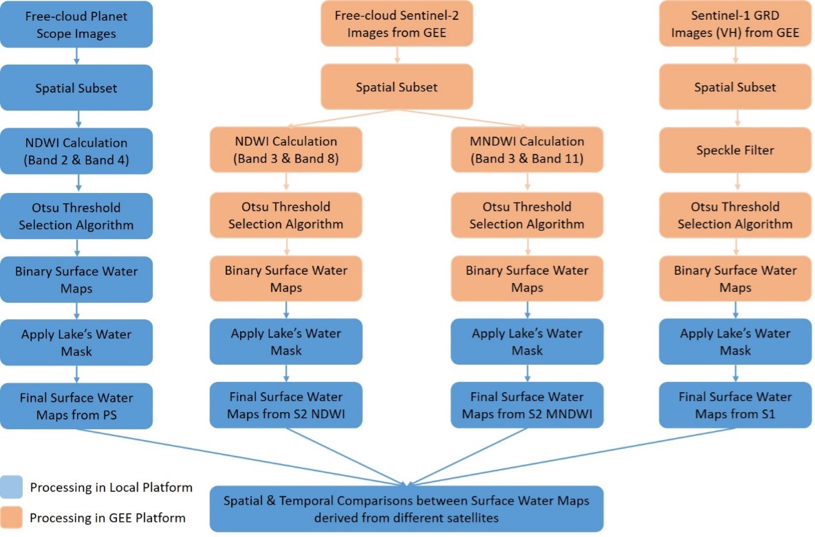
This study compares the capability of Sentinel-1, Sentinel-2, and PlanetScope (PS) satellites in monitoring the variations of surface water of Dai Lai Lake, located in North Vietnam, for the 2018–2023 period. The analysis involves the utilization of Google Earth Engine to partially process Sentinel-1 and Sentinel-2 observations, while PS observations are processed using local computers, to generate VH-polarized backscatter coefficient, Normalized Difference Water Index (NDWI), and Modified of Normalized Difference Water Index (MNDWI) maps. The method for making binary water/non-water maps primarily employs the Otsu algorithm on each single map derived from the previous step. Findings reveal that the lake’s water extent remains relatively stable over the 6-year period, and is not strongly affected by the seasonal cycle. Although the spatial distribution patterns of the lake exhibit significant similarity, average water extent of the lake derived from 3-m resolution PS imagery is about 2.17 and 5.60% more than that obtained from 10-m resolution Sentinel-2 and Sentinel-1 imagery, respectively. PS observations are effective for monitoring small lakes, but it is advised to check the quality of its NIR band. Sentinel-2 observations prove great effectiveness for lake monitoring, using both NDWI and MNDWI. For Sentinel-1 observations, potential misclassifications could arise due to similarities in VH-polarized backscatter coefficients between water surfaces and other flat surfaces.
Binh Pham-Duc; Comparison of multi-source satellite remote sensing observations for monitoring the variations of small lakes: a case study of Dai Lai Lake (Vietnam). Journal of Water and Climate Change 1 January 2024; 15 (1): 157–170. doi: https://doi.org/10.2166/wcc.2023.505

